
Honeywell Funds High-Tech GPS Unit That Inventories Creek Obstacles, Rare Species and Access Points While Aiding River Conservation Efforts
The Nine Mile Creek Conservation Council (NMCCC), joined by the Hiawatha Seaway Council Boy Scout Troop 333, today used its new global positioning system (GPS) to map creek debris and invasive aquatic plants along a one-half mile section of Nine Mile Creek. Honeywell provided the grant for the field GPS unit to the NMCCC.

NMCCC Secretary of the Board Chris Somerlot explains how the GPS system maps data to Boy Scout Troop 333 as they prepare to canoe on Nine Mile Creek.
“The Honeywell GPS grant has opened the door for a wide variety of new conservation opportunities for the Nine Mile Creek Conservation Council and our community,” said Fred Miller, president and founder of the NMCCC. “We will reap the benefits for many years – namely gathering tangible results towards continuing river and watershed conservation.”

Boy Scout John McCae records the canoe’s position one-half mile upriver from the Lakeland Canoe and Kayak Launch on Nine Mile Creek.
Canoeing upriver from the Lakeland Canoe and Kayak Launch, Boy Scouts were able to map large obstacles and invasive plants such as Japanese Knotweed, Water Chestnut, and Honeysuckle, which will help conservation and recreation efforts.

NMCCC President and Founder Fred Miller joins Boy Scout Troop 333.
“Not only have the Nine Mile Creek Conservation Council and Honeywell given us the opportunity to discover our own backyard and its resources, but today’s canoeing and GPS activities will go towards the scouts’ orienteering and community service badges,” said Troop 333 Scoutmaster Dennis Hughes.
The NMCCC will use the GPS unit to generate detailed river and watershed mapping data, which will be available for free to interested environmental conservation groups and educational organizations. The unit will map Nine Mile Creek and its watershed; locate improvement and routing options for water, bike and snowmobile trails, fishing access points, and birding routes; identify improved fishing locations; check water quality for aquatic plants and wildlife; and survey the creek for debris and navigation hazards. It will also aid in planning water trail maintenance, float-box trout stocking, and guided canoe and kayak excursions.
Hours after being collected, results from the GPS unit will be posted at www.ninemileccc.org/maps/.
“Honeywell first began working with the Nine Mile Creek Conservation Council six years ago to identify opportunities for improving access to Onondaga Lake through Nine Mile Creek,” said Honeywell Syracuse Remediation Manager Al Labuz. “Today marks our third project to provide additional recreational opportunities along Nine Mile Creek.”
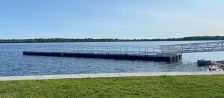
In April 2005, Honeywell and the NMCCC removed a major debris dam from a section of Nine Mile Creek, and in June 2005, built the Lakeland Canoe and Kayak Launch. Canoes or kayaks entering Nine Mile Creek from the launch can travel approximately one-half mile downriver and enter Onondaga Lake.
The NMCCC is also using the GPS unit to help Project Watershed map its water quality database; and assisting the Cornell Cooperative Extension and Save the County to inventory endangered or threatened invasive aquatic species.
For more information on the Onondaga Lake cleanup, visit www.onondaga-lake-initiatives.com.

